Tuesday 28 June 2011

Seisia to Port Musgrave


Sunday 19th June: it was strange waking up to leave. Though we have only been at Seisia for just over a week, it pleasantly seems longer.

Access in and out of the Seisia anchorage is a channel of deep water north of Red Island that is used by any boat larger than a dinghy. The actual bay past the anchorage appears on the map and GPS as too shallow to transverse in a yacht. However one cruising guide we have states it is passable and after a prior scout in the dinghy with the depth sounder, Tony had found a channel out that would save us distance and time. Just after sunrise, with the moon still in the sky, we motored across the bay.

Crab Island is rounded on exiting Torres Strait.

Approximately 14kms from Seisia we passed Muttee Heads, a heavily vegetated hill flanked on both sides by long white beaches. Muttee was a significant defence port in WW2 servicing a number of military units. In 1941 three wharves were constructed there when Jacky Jacky near Red Island Point was selected as an airfield. American and Australian troops were based with torpedo and other naval vessels that operated throughout the Torres Strait. In 1943 a Royal Australian air force radar station, know as No. 52 Dover, began operating on the hill above the beach. When the people from Sabai Island first moved to the mainland in 1948, they utilised the abandoned facilities left by the Australian and American forces. When Tony and I visited this area by road 7 years ago there were only a few artefacts of the radar station remaining – hard to imagine the presence of the war troops and infrastructure.

4.5kms further on is the mouth of the Jardine River. The Jardine flows constant freshwater and during the war water was pumped from here to Muttee Head and from there supplied to the vessels. I remember well getting bogged 7 years ago when attempting to drive to the mouth. From the sea, it appears as a section of dense green between the beaches.

Sunset at the mouth of Crystal No2.
17kms across the Endeavour Strait to our north the coastline of Prince of Wales Island, the largest of the Torres Strait Islands, was easily visible. I would really like to explore there but anchorages are apparently poor – perhaps possible by dinghy from Horn Island if we stopover there on our return, though Zowie complicates the quarantine requirements.

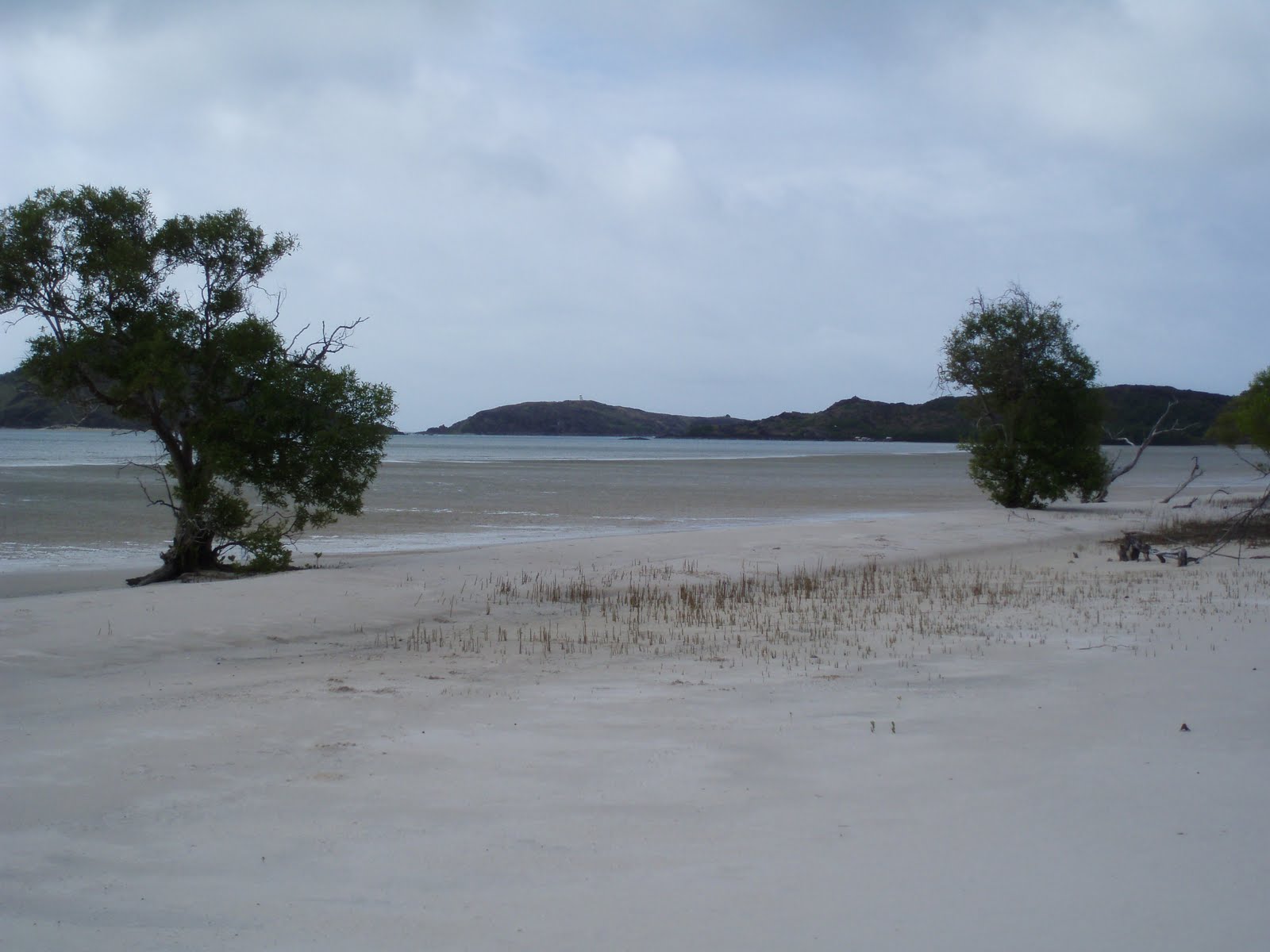
As we rounded ‘the bend’ into the gulf, we passed Crab Island, which is shaped like the claws of a crab and is favoured by turtles as a nursery. Another achievement reached and new land ahead.

The morning had been a pleasant motor sail but after lunch wind against tide made for a very sloppy rough sea, occasioning the need for a lie down until conditions improved mid-afternoon. Zowie no longer hides while we are travelling, staying in the cockpit with us unless the motion and noise is really bad. The downside of this is that she wants to continually sit on someone’s knee, which can be inhibiting when trying to do certain activities.

Nysa at anchor in Crystal No2
46kms from Seisia we turned into Crystal Creek Number 2 just after low tide. This required Tony to pick out the shallow entrance amongst shallower sandbars covered with a racing current from the incoming tide. 1.5 metres (which equates to only 50cms under the keel) was the shallowest depth we transversed – this is why we bought a catamaran. We had seen vehicles leaving along the beach earlier - there is 4WD road access from Vriliya Point, 10kms south, from where there is a track to the main peninsula road. A fishing/shooting tour group is camped at the creek entrance – the attendant small barge with logo was anchored near us at Seisia for a few days. We finally anchored at 5.30pm – after a long day Tony is again tired so hopefully the strong current here does not necessitate any late night manoeuvres in the dark.

Vehicle access to Crystal No2 is by 4WD along the beach
Monday 20th June: Mid morning we walked a few kms along the coastal beach to the wreck of a steel steam ship. With the tide going out, the beach and exposed sandbanks made a lovely sight against the aqua coloured gulf waters. The wreck is very interesting – the chimney has fallen to the side but looks too tall for the size of the ship, which is very broad for its length and has an unusual bilge keel. The oysters covering the rusted remains indicate it is submerged at high tide, but at low the water left in the hull pours into a pool of water under the bow which contains small fish and a crab.
The bush camping areas at the creek mouth are on flat sand shaded by casuarinas – very pleasant and obviously popular. It was surprising to see a helicopter there this morning, which left and returned late afternoon, left again and returned on sunset - presumably carrying customers for the tour company, which would make it an expensive but very scenic experience.

As always, the rubbish along the beach is sad – I would love to have someone pay me to clean up the beaches regularly.

This wreck is just south of Crystal No2

Sleep last night was regularly broken by the alarm as we swung with the current. After the walk we did a reccy of the creek to find a new location. I don’t know how it is decided what is a creek and what is a river, but Crystal Creek is a very wide expanse of water. The northern side is muddy with mangroves and the southern, sand with bush. We disturbed a large crocodile, at least 3 metres, on asandbank and as it slid into the water we decided to retrace our route. The next crocodile seen was only 1 metre and seemed nothing to worry about in comparison.

All that remains of the superstructure
After a late lunch we moved Nysa further along the creek into shallower water that hopefully won’t be affected by the currents as much. We have telephone reception but no internet.
Tuesday 21st June: peaceful undisturbed sleep. This morning’s high tide gives the illusion of a wide uninterrupted opening at the ocean entrance, and the creek itself appears as a lake. At low tide the entrance dwindles to a stream meandering snake-like through the sand, while the creek becomes definite channels separated by sandbars.

After lunch we walked along the northern beach to Crystal Creek Number 1, approximately 4kms away. The beach is largely under water at high tide. At the varying tidemarks is an abundance of shells the shape of cockle but in all variations and colours. I am drawn like a magnet to walk where the shells are, which is always in the full sun. Tony prefers to walk near the fringing Casuarina trees that provide shade and birds. Above the high tide delineation he found a number of turtle tracks, presumably nesting. A dugout canoe was also found past the trees lodged in mangroves – possibly swept there in a storm?  The entrance to Crystal Creek Number 1 dries out at low tide, and the creek behind was so shallow even a catamaran would be sitting on the bottom. Another very enjoyable walk.


Huge expanses of sand at low tide

While watching a DVD at night we unexpectedly heard quacking/honking and then a hard thump – no injured duck or goose (? Magpie goose?) found on deck or in the water so hopefully no permanent damage done – obviously did not see our anchoring lights!

Wednesday 22nd June: heavy dew obscured the windows on waking. We motored out of the creek on the high tide at 7am when there was sufficient water even for a deep-keel monohull. The wind kept dropping out as we headed south, but when present was a southerly. This was the first time we had sailed Nysa into the wind and Tony was pleased how well she handled it, averaging 4-6 knots. The sailing was also accentuated by the music we could now enjoy on the CD player.

Vrilya Point 10kms south was stark with its red bauxite cliffs flanked either side by white sand dunes.  Arrived on the outskirts of the Doughboy River, 28kms from Vrilya Point, right on low tide at 4pm. We deferred our attempted entry at 1metre under the keel as Tony was concerned swell would bounce us on the bottom. Anchored offshore to wait for the incoming tide. In the meantime Tony did a reccy in the dinghy with depth sounder and handheld GPS – I gave Tony the handheld GPS and personal EPIRB years ago when he used to do solo bushwalks; at least now he is using them again. On the GPS he plotted the deepest channel and found an anchorage in the river. Just as the sun was setting I persuaded him to move – Tony was happy to do the entry in the dark following the GPS but I was not. With the incoming water we safely anchored as pitch blackness descended.
Dugout canoe found in the mangroves
During the afternoon reccy Tony had attempted to contact me using the handheld radio, which brought to our attention that the aging marine radio on board could receive transmissions but not transmit. Having the handheld means this is not a major problem as we can use it to contact others  – we just can’t stay in contact with each other when one is in the dinghy or on land, and the other on Nysa. Once we are in internet range we will mail order a replacement.

Thursday 23rd June: at lunchtime we were surprised to see 2 Giant Qld gropers at the back steps. The largest was about 2 metres – we guess they probably check out all new arrivals for possible titbits. We then dinghied along one channel of the river – the waterways are extensive and broad, lined with tall mangroves holding the soil that is all mud.
A walk along the northern beach was quite depressing – there was the usual flotsam but an incredible number of plastic bottles, of all shapes, sizes and uses obscuring the sand. Those with writing still evident showed both English and Asian speaking sources. There are also a lot of light globes – household and large spot light – it is interesting how the glass stays intact. You contemplate trying to clean up the rubbish, and the amount is over whelming. Even a campsite amongst the casuarina trees had tin cans in the fire – I can never understand how people can bring food in but can’t take the rubbish out. This is the most desolate damaged beach we have seen and it really is sad.

There is no road into the Doughboy though tracks on the beach indicate vehicles drive here from the Cottlerell River, which is about 9kms north with road access – our friends Shirley and Ken camped there over the long weekend. We were alone here until mid-afternoon when a dinghy arrived from ? where with a lone fisherman – definitely mad keen, especially as he was still in the river when dark fell. Not what I would call fun, but then I am not a fisherman.
Rock bar stopping progress upstream on Doughboy River
Currently there is a strong wind warning, and though we are registering gusts to 30 knots and there are waves in the river, it isn’t uncomfortable as yet. There is no telephone or internet access in this location.

Tying the dinghy to the side of Nysa we could see in the spotlight that we still had a resident groper.

Friday 24th June: on the early morning incoming tide we dinghied along the largest of the channels looking for the fresh water source of the river. Amongst the mangroves, nypia palms (tall and straight, grows in clusters with large ball shaped seed pods) that can grow in salt water appeared intermittently. After a long distance the vegetation became a mix of mangroves, palms and paperbarks until eventually the freshwater vegetation of trees, shrubs and palms was only present, the clear water tasted non-brackish and the birdlife was more abundant. The channel remained wide, though quite shallow in parts. A submerged rock or log put a few dints in our propeller. Unfortunately for Zowie there was no landing spots as the banks were steep and heavily vegetated. After travelling approximately 7kms, we had to stop where a rock shelf totally crossed the river forming rapids. The pool in front of the shelf was 7 metres deep – though not tidal here, the downstream incoming tide could cause a build up of the fresh water at this shelf, so in theory the outgoing tide could see this level drop and then there would be a small waterfall across the river. Waiting for the low tide and then the high again to navigate back down the river was beyond our capabilities, so this remains a theory.
Freshwater section of Doughboy River

On the return trip a small 1 metre crocodile was seen entering the brackish water and a much bigger 2 metre crocodile in the tidal section. Once back we took Zowie to the entrance beach for a quick walk. The wind was increasing, whipping sand horizontally. By the time we were resettled on Nysa late morning, the winds were registering 25-40 knots. The fisherman was not in the river this morning, so I hope he is somewhere sheltered. Surveying the landscape late afternoon I decided this was the most unattractive anchorage we have had.

The resident gropers stayed either at our back steps or under the dinghy floating at the stern. By spotlight at night, a 2 metre shark was also seen by Tony – possibly a thresher?


Saturday 25th June: by the morning the winds seemed to have calmed so we left on the ample depth of the in-coming tide. A pleasant sail in 15-20 knot winds was occurring until we were suddenly hit by a squall. With the sudden rush of momentum and noise, Zowie headed for the bottom step and refused to budge – possibly planning to jump ship? As we didn’t need a dog overboard right then, Tony lunged and grabbed her by the loose skin along her back and dumped her in the cockpit. We pulled the front jib sail in as the wind hit 31knots, breaking a pulley cog in the process (another mail order needed to replace the spare). With the aid of the motor we moved Nysa closer to the coast and dropped the mainsail. Once at a calmer distance inshore, we raised the jib again and motor sailed fairly comfortably the remaining distance to the Jackson River, although winds still 25 - 40 knots.
Nypia Palms on Doughboy River
The Jackson is 24kms from the Doughboy and there was ample water to enter the mouth at 1pm as just past high tide. A 1.5 metre crocodile was on the mouth’s southern beach as we approached. Similar to the Doughboy, there is a section pass this beach of tall dead trees – possibly died from encroaching salt water.

Since leaving Vrilya Point the coastline has been one long low vegetated sand dune, separating the rivers from the gulf. Due to the shallowness of most of the river mouths, it is all about timing. If you leave one on the high tide, you probably will get to the next on the low, which may not work.

During the afternoon 3 dinghies arrived and zoomed down the river. Earlier in the day we had sighted a large white ship anchored outside the MacDonald River to the north. We guessed it was a fishing tour boat possibly waiting for its guests fishing in the river. Prior to the dinghies appearing we had seen it passing outside of the Jackson mouth and guessed that is where the dinghies returned to on sunset – we toasted each other with our sundown drinks as they passed.
Nysa on the Doughboy River

Sunday 26th June:  mid morning we walked pass the forest of dead trees to the mouth’s southern beach. The flotsam of buoys, nets and ropes is not as heavily polluted with plastic as Doughboy. Sighted a sea eagle soaring over its nest with 2 chicks present. The white fishing tour boat is anchored offshore, though only 1 dinghy returned to the Jackson this morning. The others may be in the Skardon River, which is only 7.5kms south? Whirly Whirlys whipped across the sand and walking back into the wind was tiring.  It is 15-25 knots today with occasional gusts to 30.

Tony finished putting speakers in the cockpit so now we can listen to CDs in surround sound.

Late afternoon 3 dinghies with caucasian families arrived and set up camp on the riverside of the mouth’s northern sand due. We expect they are from Mapoon, an Aboriginal Community 35kms south, on school holidays, as any further in a dinghy would be hard going? They are much braver than me camping only a few metres from the water’s edge.


Jackson River


The stars at night are amazingly bright – quite the wow factor.

Monday 27th June: 11am we left on the incoming tide and motor sailed to Port Musgrave, which is a large bay into which the Ducie and Wenlock Rivers flow, and where Mapoon is located. It was a calm day with the winds never above 20 knots. The coast was just one long stretch of vegetated sand. At 5pm we anchored on the eastern entrance to the bay, opposite Cullen Point, which is the western entrance. While we relaxed with a drink and appreciated bush instead of mangroves on the shore, dolphins feed around us, a sea eagle soared and a hammerhead shark broke the water surface next to Nysa – this is the first hammerhead I have ever seen. There is sufficient smoke in the air to smell it – apparently burning off occurs. The sun setting over the ocean is a golden globe and we have telephone and internet reception again.
Ghost fishing nets are very common on the west coast.

Seisia

Monday 13th June: By the grace of God and the skill of Tony, we survived last night. Early evening there was tide against southwest wind and in the rushing current Nysa was literally doing 360’ circles. The monohulls were like ice skaters, gliding helter skelter. ‘Wombat’ and ‘Shilling’ behind us came close enough for the owners to almost shake hands, and were insidiously creeping closer to us. Occasionally our circle on the GPS would be just slightly bigger and then suddenly with a wayward movement around 9.30pm we knew we were dragging and it was us getting far too close to the monohulls. Pulling up the anchor was a strategy in itself as the spinning had it under us and once it was dislodged the current put us right between ‘Wombat’ and ‘Shilling’. As we moved sideways between them, Tony expertly forwarded and reversed just sufficiently to keep us central - I could have touched them if I stretched. Owners came out to say a friendly hello, but of course were really there to fend us off if needed. Upon regaining control we had planned to motor further forward to re-anchor but the large cargo ship ‘Trinity Bay’ also happened to arrive at this time and at a fast pace went past the jetty and towards us. So until it stopped and slipped back against the jetty, we manoeuvred with difficulty between the yachts and fishing boats – we could not just sit and idle in one spot due to the tide/wind/current effect. Luckily it was a near full moon, as many of the local boats do not have anchor lights and it would have been impossible to see them. Our trusty spotlight though was also needed. My heart simply stopped beating during all of this as I dashed from side to side making sure we were clearing each boat. Plus it was very cold. Once we knew the barge was securely berthed we anchored knowing it was too close to the jetty to allow sufficient space for the ship to turn and leave. A radio call to ‘Trinity Bay’ confirmed they were not leaving till tomorrow night so the skipper was happy for us to remain in our position and then move in the morning.  Around 11pm we retired to bed but whereas competent Tony slept, I nervously kept checking everyone’s swing until about 2.30am. The whole episode was very draining.

"Trinity Bay" unloading at Seisia
Last Friday Tony had found a channel of water past the sandbar skirting the beach – we had considered moving there then but were too indecisive. Now we were decisive and just after 7am motored over the sandbar and relocated – as I reminded Tony the benefit of a catamaran is to go to shallower waters where monohulls can’t!

In the afternoon we walked around Seisia, which is an attractive well kept community. The locality was settled by inhabitants of Sabai Island around 1948 after a tidal surge reduced the landmass. There is a monument to Mugai Elu who was chairman of Sabai at this time and oversaw the move and re-establishment of the community. He was a highly respected leader who in his lifetime dived for trochus, was captain of a trochus and pearling lugger, a corporal in the WW2 Torres Strait Infantry Battalion and church deacon.

‘Wombat’ left at lunchtime and 3 other yachts arrived. Most of the yachties then meet at the Caravan Park for a BBQ – there were 16 people including us: one couple from Maitland NSW and ‘Landin’ from Gosford, otherwise from England and America and all doing the rally to Indonesia. From there some plan to join a rally to Malaysia, some will self tour Asia, others will put their yacht onto a cargo ship to go through the Red Sea to the Mediterranean (to avoid the Somali pirates) and one boat is off around Africa. Also meet Greg who runs gulf and island fishing charters in the 20 metre power catamaran anchored amongst us.
Chris hard at work writing her journal
Tuesday 14th June: Shirley graciously lent us her car and use of her washing machine this morning. Took the opportunity to also shop at Bamaga supermarket that had some items I had not found at Seisia. Bamaga is about 8kms inland.

While at Shirley and Ken’s we meet Russell Hubbard, the Cairns locksmith who flies to the area for 1-2 weeks a month – he covers the mainland communities and islands, flying by helicopter to the furthest out. Russell has had some wonderful experiences and we would love a job like his that gives this opportunity.

Shirley then had lunch with us on Nysa and I excitedly showed her the patchwork items I had made so far on the trip. Shirley is incredibly talented in a number of crafts and it was she who encouraged me to pursue patchwork lessons. Before leaving for Bamaga, Shirley had given me some appliqué patterns and material. I was able to show her how I had made a carry case for a lap table from these.

4 of the monohulls left this morning to cross the gulf and 3 new ones arrived.
What an idyllic location for the Church at Seisia
Dinner was at Shirley and Ken’s with their friends Trish and Steve who have lived and worked at a nearby community for a number of years – it was a very enjoyable evening.

On our return to Seisia the water was calm for the first time in a number of days, which was a great asset getting back onto Nysa in the dark.
Anchorage at Seisia
Wednesday 15th June: the calm conditions have thankfully continued and south-easterly winds should return in the next few days, allowing us to continue around the Gulf. 3 monohulls left.

All the locals we had meet at Seisia and Bamaga have been incredibly yachtie friendly and helpful. It is also a mix of traditional and modern worlds eg. A young islander man stands at the shoreline fishing with a spear while listening to his ipod.

The sunsets have been brilliant – each night different depending on cloud cover.

Thursday 16th June: 1 catamaran and 2 monohulls left this morning for Horn Island, so the anchorage was looking very empty until 1 catamaran and 3 monohulls arrived. The water is becoming clearer and blue again so we may be able to use the desalinator soon. Daily trips to fill water and fuel containers is very time and energy consuming, though we are grateful for how convenient it is here.
Wreck in Seisia harbour
We now have FM radio and CD music – though Tony installed our new CD/radio player weeks ago, only today was it connected to speakers. This is great as I have missed music.

Friday 17th June: the winds are again south-east and a nice strength but we need to wait for the right tides during the day to round the mainland into the gulf - apart from needing clearance in some very shallow areas, the current needs to be going with us. Apparently the current is so strong that even if motoring, forward progress is difficult against the current. I just hope the wind strength does not increase by the time we leave.

However this does give us more time with Shirley. Ken is currently away with work so the 3 of us had dinner at the local Fishing Club, which Nysa is anchored in front of. The DJ played a varied mix of music but we did manage a few dances, which is always enjoyable, even wearing rubber-soled shoes on a concrete floor. His lighting though was the best I have ever danced under.
Tropical sunsets are not to be missed
Today’s mail also brought a new ignition switch for the hotplates and material I had ordered via the internet – poor Tony patiently listened while Shirley explained the intricacies of materials and sewing techniques to me – she is keen I commence a quilt in blocks, and I may consider that once home.

Today 1 catamaran and 2 monohulls left – 1 new monohull arrived. Obviously not going around the gulf like us.

Saturday 18th June: 1 monohull left and we were the only non-local in the anchorage until 2 monohulls arrived late morning. With Shirley we visited Red Island, which is only about 100 metres from the Seisia jetty. The anchorage is between the beach at Seisia and Red Island, and I have been wanting to explore the island all week. It has low hills covered with long grass and a variety of short trees. Late morning was low tide and we walked along 2/3 of one side. Unfortunately there was a lot of rubbish brought in by the tide, but apart from the need for a clean up, it is a lovely island and I hope to be able to return and explore more. One small section of beach was composed of a myriad of small shells – similar to Shark Bay in WA on a small scale. We had a picnic lunch and as we left Red Island Shirley and I were fortunate enough to see a good size spotted stingray leap vertically out of the water, turn and dive back in – it was amazing!

We then made our farewells as we plan to leave tomorrow- there is no consensus with the various tide sources, but if the timing is wrong we should be able to find an anchorage somewhere on the coast as the forecasted wind is not to bad.

Tony has commenced our blog: http://sv-nysa.blogspot.com. To date it only has the beginning of our trip, but does include photos, and will be added to.

Sunset is again magnificant, the water is calm and all is tranquil. We are rested and hopeful the trip will continue well???

Monday 27 June 2011

Mount Aldophus to Seisa

Monday 6th June: last night we watched a lovely sunset over the ocean. This morning we awoke to the weatherman predicting 20-25 knots for the next few days. Since the forecast is usually less than what we actually experience, we decided the risk of 30 knots was sufficient to cut short our visit on Mt Adolphus Island. We were secure there, but if the wind was high for the remainder of the week, there is more to do on the mainland. Left 9.30am and although already 20-25 knots, the waves were quite manageable. Saw 2 monohulls exist Albany Pass and then continue onto Horn Island.  We rounded York Island, which is situated approximately 50 metres from the tip of Cape York, and anchored in the adjacent bay at 1130am. In the next few hours 4 monohulls joined us – 3 from England – with the wind hitting up to 35 knots. The bay however is reasonably calm, and we can see Horn and Prince of Wales Islands (in the Torres Strait island group) in the distance.

Mt Aldolphus Island anchorage
Tony is very tired and needs a few rest days – the wind has been too noisy for a good night’s sleep.

Last night we spoke to Tarrant who unfortunately had tools and equipment stolen from his rental vehicle while working in Brisbane. This is an upsetting expensive setback.

Tuesday 7th June: we had planned to walk to the Tip and along the adjacent beach this morning, but with consistent gusts blowing 44 knots (approx 90 kms) we decided to stay on the boat. Surprisingly the 3 monohulls from England left and headed to Seisia approximately 30kms away – obviously used to extremes of weather. The other small wooden yacht moved closer to the land. More surprisingly, presumably local people are still travelling out to the open ocean in dinghies!
York Island on the left, tip of Cape York on right.
I’m very impressed with my pegs that securely kept clothes on the safety lines during this wind. Also pleased with my food stocking – for 5 weeks we have eaten well and are only now resorting to tins and dry food. Once we do reach Seisia we will restock the best we can.

By mid afternoon the gusts were spasmodic and down to 30 knots, so we went to the beach. There were a number of 4WDs with people visiting the Tip. Amazingly 2 men stood waist deep in water fishing – apart from the crocodile risk, large sharks also live in these waters!

The beach is a few kms long with a beautiful rocky headland called Bay Point at the opposite end to the Tip. At low tide the wet sand is covered with the trails of molluscs – you could find the small shells about 1cm long (possibly whelks) at the end of each trail. I find it interesting that some beaches seem to ‘specialise’ in one particular life form: Margaret Bay – stingrays; Shelburne – starfish and now here, molluscs in shells.

Just prior to sunset 2 large catamarans entered the Bay.
Low tide at "The Tip"
Wednesday 8th June:  overcast, showery and windy still. The other 3 yachts left early morning.

We received an email from Clare, Tarrant’s girlfriend, with a scanned copy of a Centrelink letter stating if I did not submit certain documents by today my mother’s pension would be cancelled. I was distraught. 2 years ago when sailing Nysa from Brisbane to Cairns I had numerous difficulties with Centrelink trying to sort out my parent’s entry into residential care and the changes this meant to their pensions - again when we had very limited phone and fax access. Centrelink must be psychic and knew I was in a similar situation again. Nor was I expecting this, so did not bring any of my parent’s documentation with me. Luckily though I was in telephone contact today and after 2 long phone calls, they say the matter has been sorted – unfortunately I have heard this before from them and things weren’t. I can only hope.

With this dilemma hopefully clarified, we headed to the beach to walk to the Tip with the other tourists. From the ridge we could see where we had sailed around Albany and Mt Alpholphus Islands. Spoke to one tourist who, as many do, had driven up from Cairns in 3 days to visit the Tip and now was going to drive back just as quick – they miss so much beautiful country up here. Nor have we seen anyone walk the long beach in front of us. Just drive to the car park, walk to the Tip, take a photo, and leave – a bit sad but everyone has different time available to them. Zowie had her photo taken at the Tip and at least she has walked the beach.

Miserable weather at "The Tip"
Thursday 9th June: still dismal weather. Tony climbed to the top of York Island, 180 metres high in 15 minutes. The island is a large rocky outcrop covered in grass tufts and small shrubs – at least no spear grass or green ants. At the top the view along the coast was apparently worthwhile. At a cairn someone had left a notebook and pencil in a plastic bottle, but unfortunately the bottle had broken and the writing was now illegible. Needs replacing by someone who is aware of this fact before they do the walk. Tony found me on his way down, progressing much more slowly and about two-thirds the way up.  Before descending we sat and watched the continual line of people walking to the Tip – the numbers each day had increased and today there was literally buses. 21 years ago we were a day’s drive from the Tip when we turned around because we could not cope with the crowds then. 7 years ago Tony and I did finally do the drive to the Top, purposely in November to avoid the crowds – it was great, we had every campsite and the Tip to ourselves. I’m not sure we could return to land travel again, unless it was very remote.
View from the top of York Island
After lunch we left for Seisia – the overcast weather has affected our solar panels ability to provide power, so though 20-25 knots we motor sailed to charge the batteries. Though windy the sea was fairly calm west of the Tip. Passed Possession Island where a monument marks the proclamation by Captain Cook of England’s ownership of the east coast of Australia. Arrived about 5pm to find the 2 large catamarans and 4 monohulls that had stopped over at the Tip, plus fishing boats. We cannot believe how still this anchorage is and it is 6 weeks since we have had so much company. We spoke to Murray, owner of the catamaran ‘Shirazz’, a 39ft Fontaine; they and the other yachts are waiting on good weather to cross the Gulf to join the rally to Indonesia from Darwin.
Friday 10th June: surprisingly ‘Shirazz’ and the 10 metre Sea Wind catamaran ‘Truansea’ (great name) left during the night, although the forecast for the western gulf is 30 knots over the weekend.

Met Beth and Bone from the monohull ‘Splinter’s Apprentice’ who have been sailing the world since 1998. They have been travelling with the other 2 English monohulls since Brisbane and are not impressed with the noisy, windy Eastern coast anchorages.

Upon landing on the beach to obtain some groceries we sighted a 2 metre black snake having difficulty moving up the wet slope back to drier land. Eventually it succeeded and we both headed in different directions. The new supermarket is expensive but well stocked and easily accessed from the beach.
"The Tip" and Albany Passage (background) from York Island


We were delighted to have friends Shirley and Ken for dinner on Nysa. Ken is the school principal of Bamaga  and surrounding communities, while Shirley is the Diabetes Educator. They are half way through Ken’s 5 year placement and both really enjoy living here. We were invited to take Nysa camping with them over the long weekend but we need to restock and reorganise.


Just as twilight was dying a monohull arrived and anchored near us.

Saturday 11th June: Tony is suffering from painful gingivitis requiring analgesia and did not sleep well. Hopefully our new supply of fresh fruit, including pawpaw from Ken and Shirley’s garden will help.

Met the owners of the newly arrived monohull ‘Landin’, a 46ft Hunter – Kevin and Trish are from Gosford NSW and have sailed from Sydney to the Whitsundays for over 12 years. This year they are doing the Indonesia rally. Trish was booked to have a hip replacement in October after the rally, but due to increasing pain over the past weeks she has rescheduled for early July (will fly home from Darwin), planning to rejoin the rally 2 weeks after. Their 2 sons Matthew and Aaron are with them, so the 3 men will do the initial section. Tony raised with Trish the distinct possibility that she may not be able to manage flying and boating for a lot longer than 2 weeks –she seemed unaware of aftercare limitations and recovery expectations – but she feels unable to postpone the operation.
Safely at anchor at Seisa

Another monohull, a 47ft Beneteau, known to Kevin and Trish arrived – ‘Wombat in Sydney’ is owned by an American couple who have been criss crossing the world for decades and are currently off to South Africa.

With light variable winds and strong currents all the boats wander in different directions. The water is murky and weedy so we are unable to use the desalinator. To obtain fuel and water from the shore requires quite a bit of effort – jerry cans into the dinghy, park on the beach, carry the containers to the tap on the jetty for water, and the petrol station for fuel is about half a km away. We have a trolley but it can only take one jerry can at a time so we will be doing a trip every day we are here. The main difficulty is the weight of lifting the full jerry cans into the dinghy and then from the dinghy onto Nysa – even Tony admits it is hard work.

The caravan park on the beach allows yachties to use their laundry facilities, which is another help. 

We have been yearning for takeaway so visited the Caravan Park kiosk for dinner (impressed there was vege burgers). We had been asked over to ‘Landin’ for after-dinner drinks but on the way the outboard motor on the dinghy died. Luckily we are all anchored fairly close to shore and Tony rowed first to ‘Landin’ and then back to Nysa – also really fortunate they had anchored close to us as the current made rowing more difficult.

‘Landin’ is planning to leave with the other 4 monohulls to cross the Gulf together. All these yachts are in beautiful condition – well loved and cared for.

Sunday 12th June: though the wind is only 5-15 knots, little sleep for me as Nysa went around in circles and the dinghy tied to her side splashed and sploshed all night. Tony slept better but woke feeling unwell; the gingivitis is improving but he has neck and back pain from the heavy lifting in awkward positions. I am concerned that he just does not stop – always working.

It is another overcast cool day requiring us to resort to the generator to boost the batteries.

Tony worked all morning on the outboard – reason for problem never became obvious, but after cleaning and checking everything it worked. We were just thinking about lunch when the tide changed and boats started swinging in all directions, including our dinghy now attached to the back of Nysa with 2 ropes. This haphazard wayward movement went on until everyone had settled into a new position. And then, in a split moment, we had a problem. At some stage the dinghy went to the side of Nysa and a rope became jammed between the hull and rudder – not good. Tony was unable to free the rope with a hook. Very mindful that a crocodile is known to inhabit this area, he made a grab hold with a rope and laid on his side on the bottom step. With one arm twisted behind him to hold the rope, he leant out over the step and freed the rope with his arm submerged to the shoulder. He was amazing – I continually am awed at his abilities and tenacity. Unfortunately this effort made an ill man only feel sicker and he was forced to rest.

Dennis and Janet from ‘Shilling’, a 43ft Oyster, visited for afternoon tea. They left England 12 years ago and have sailed from Alaska to Mexico and the Pacific. Entered Australia via Bundaberg and headed north to join the rally to Indonesia. No plan to see Australia – with our strengthening dollar and the weaker pound, Australia is too expensive to spend extended time here. After cruising around Asia, to avoid the Somali pirates, they will place ‘Shilling’ on a cargo boat to go through the Red Sea to the Mediterranean.

Ended the day with Tony feeling slightly improved and a walk along Seisia Beach. 7 years ago Tony and I were walking along this beach when we met a yachtie loading water containers into his dinghy. We had looked out at his yacht in calm water with a beautiful gold and red sunset behind it and thought that cruising may be something we would do one day. The sunset tonight is again magnificent, but the romance of sailing is all an delusion

Saturday 18 June 2011

Portland Roads to Mount Aldolphus Island


Sunday 29th May: well the other yacht left before we even awoke and could not been seen on the horizon.
Upon leaving we caught sight of another catamaran on the horizon – it must have started very early in the morning as the nearest good anchorage south is Lockhart, or possibly sailed all night? Everyone else seems to be in a hurry.

15-20 knot winds, with occasional higher, provided pleasant sailing along Weymouth and Temple Bays. The crews of trawler boats must have a hard life but today we saw lone men in dinghies long, long distances away from the mother fishing boat in quite rough conditions, which no doubt can get worst than today – you would have to love fishing and getting wet and sunburnt for that job!
Enormous cargo ships are appearing more frequently – silent giants that seem quite surreal in appearance as they glide into vision and pop up from behind islands and reefs.

After lunch I decided a lay down would help the nausea I was starting to feel. Tony woke me at 1430 as we approached the Home Island Group.  The largest of these is Hicks and 3 very large modern houses are situated here. The islands are all flat, with low vegetation, some beaches and extensive reefs.  We had already passed Haggerstone Island, which has a resort. This is very remote living. The cost of building would be astronomical and access from the mainland is by plane – the weather does not provide easy or quick water access and there are no major roads on the nearby mainland.
Beach walking Margaret Bay-photo by Jon Glaudemans
From here we rounded Cape Grenville and anchored in Margaret Bay in time to re-plenish the biscuit supply.

The other yacht came in soon after – we crossed paths a few times during the day; they are a more modern and bigger catamaran but as they avoided the shallower reef areas, we kept ahead.

Monday 30th May: our nicest day to date. Meet Jennifer and Jon Glaudemans on ‘ile de Grace’ (Isle of Grace), who are from Maryland USA, currently about half way through a 3 year trip circumnavigating the world. They had arrived in Cairns from Vanuatu after crossing the Pacific just prior to Cyclone Season, and during the wet visited Thailand and New Zealand by plane. Jennifer and Jon had left Bathurst Bay last Saturday and sailed non-stop till yesterday afternoon. In one week they had travelled what had taken us four, but they are not sight seeing. They need to get north quickly to have the right timing to travel west to Irian Jaya and then across the Indian Ocean to round South Africa (increased pirate activity from Somali has cancelled their plans to go via the Suez Canal to the Mediterranean).  From what they told us they had seen and done in the Pacific, Qld would not compare anyway. http://sv-grace.blogspot.com is their very informative travel record.
Photo by Jon Glaudemans 
We have both been told by different sources that Indian Bay across the headland was great for beachcombing, but Jennifer and Jon were not confident to go alone with the possibility of crocodiles and snakes. So the 4 of us packed a picnic lunch and trekked for an hour through long grass, slushy muddy lowlands, bush and mangroves. There is a rough path marked by mainly blue items of flotsam (eg. bits of rope, thongs, toys, plastic construction helmets). Of course, there were plenty of green ants. Both beaches are totally submerged at high tide, with long expanses of flat white sand at low. The floating ‘lost treasures’ are found behind the fringing mangroves. I was disappointed in the beachcombing though – plenty of buoys, driftwood and helmets, but otherwise just broken rubbish, particularly plastic bottles. I had been expecting similar to the beach north of Cooktown where we and others found in good condition: hats, cushions, cameras, wet suits – basically anything that could fall off a boat. The only other flotsam on Indian Bay was masses of blue bottle jellyfish. But the company and conversation was excellent. Zowie arrived back covered in mud requiring her first bath on the boat.

Red Beech en route to Indian Bay. Photo by Jon Glaudemans
We then had dinner on ‘ile de Grace’, a 44ft Fountaine Pajot – built in France and sailed back to America by Jennifer and a delivery crew. The great back deck alone is bigger than our saloon. Freshly caught tuna was a treat for Tony.

Tuesday 31st May: A monohull was anchored on our return to Margaret Bay yesterday but had left before we awoke this morning. One fact we all bemoaned at last night’s dinner was how hard it is to maintain fitness on a boat. When we commenced this trip I found my exercise program quite easy as the weights were much less than I would use at a gym. By this morning these same light weights are becoming hard going, so it is already a concern.
Photo by Jon Glaudemans
After lunch we dinghied to the beach closer to Cape Grenville which I call Stingray Bay due to the number of stingrays!  Mangroves enclosed the beach and the sand was separated by sections of slippery mud, so not as nice as Margaret Bay.

‘ile de Grace’ left at 3pm planning to sail non-stop and arrive at Horn Island tomorrow afternoon. After organising some things there, Jon and Jennifer will exit Australia from there. Another catamaran and 2 monohulls arrived during the next 2 hours, all ‘fast-tracking’ to the Top as well. We plan to meander for a few more days.

I am becoming concerned about crossing the Gulf of Carpentaria as it requires 2 nights of non –stop travelling: for us this is a major problem - I can’t sail and Tony can’t stay awake for 3 days.
Photo by Jon Glaudemans
Wednesday 1st June: awoke to 2 of the other boats already on the horizon. We motor sailed 2 hours to Shelburne Bay, primarily to reduce the long day needed tomorrow to reach the next good anchorage, and because Tony wanted to see it. The terrain has progressively flattened since leaving Portland Roads and Shelburne is very flat with occasional hillocks. We passed a red bauxite cliff face flanked by white sand dunes, but overall Shelburne is not as scenic as we expected. As at Indian and Margaret, high tide reaches the mangroves with low tide exposing a long, though not as wide, beach.

During the day 2 dugongs were briefly sighted but by mid afternoon, when the tide was right to visit the beach, I was not feeling inclined. 20-25 knot winds buffeted us all day and I am feeling tired of the whole thing, so getting to the beach just seemed too much effort. However every beach is upliftingly different and I have renamed Shelburne Starfish Beach.
Photo by Jon Glaudemans

The sand was literally covered with the imprints of starfish – have not seen this anywhere else. The beach was also potholed with various size pools still filled with water. In each was at least 1 live starfish, while I counted 40 in one pool approximately 1 metre across. They also moved a lot faster than I have seen starfish do previously.

In one drying puddle we found 2 small silver fish flailing and gasping – with the aid of Zowie’s drink bowl I moved them to a nearby deeper pool, where they swam quite contentedly – hopefully the tide will have returned in time.
Indian, Margaret and Shelburne have all been sparse of shells but in one possibly permanent pool I found hermit crabs and a shell actually with an inhabitant mollusc moving along the bottom of the pool. Even diving I have never seen a shell with its mollusc evident. Further along I found another shell with mollusc on drying sand – I moved it to a nearby pond and hoped it would be okay.


Photo by Jon Glaudemans

A number of years ago a kayaker was attacked by a crocodile in this Bay and help was obtained when a passing plane saw writing in the sand – considering the writing would only have been possible at low tide and with little non-mangrove land  present at high, he was very lucky to be rescued. It would have been terrifying.


Thursday 2nd June: left at 5am and it was pitch black. The stars were magnificent but we could not even see the water. Tony was confident using compass bearing, GPS and radar to know where we, and everything else, was. I, however, felt extremely unsure and anxious. This area is not even fully surveyed so I was expecting to hit a reef, and not being able to see the size of the waves before they hit is daunting. To sail all night I would need the benefit of a full moon, which is not always possible, and I would still expect the worst!

I did feel better with the rising sun but the wind and waves were messy and rough all day, requiring us to motor sail to maintain the 7 knots needed to get to our next anchorage before dark. The thought of having to do days and nights like this is claustrophobic and sickening. The longest stint ‘ile de Grace’ did across the Pacific was 21 days – I realise all long distance sailors do this (and why Jessica Watson, Jesse Martin and others do it for months is unimaginable), but I am now even finding the thought of 3 days across the gulf impossible.  I have had enough; I am not a sailor; I do not enjoy being continually frightened; I would like to sell Nysa and go home, but as we have to wait months for the wind to change direction, that is not going to happen, so I just feel a failure!
The coastline continued as beaches, low vegetated sand dunes and cliff faces. We crossed the sand bar into Escape River at 4.30pm – even though low tide this was fine. The difficulty with this river is the Pearl Farm, which has pearl rafts literally everywhere in the first 2kms. The buoys from which the rafts suspend are mostly black and it would be impossible to transverse the river in the dark and not run into a raft.  Even in the daylight, a lookout is needed as you weave around them. By 5.30pm we eventually found a space large enough to anchor. At least it was calm and the sunset pretty.

Friday 3rd June: one monohull from Margaret Bay was in the river when we arrived yesterday but left early this morning. We are having a rest day after yesterday plus we need to work out the tides and currents to leave on to facilitate arrival at the next anchorage. What we are actually visualising with the tides in the river is not corresponding to the GPS tide chart? By 9.30am it is blowing 25 knots, so would not be pleasant outside – hopefully will be better tomorrow, but we can’t rely on the weather reports that are not predicting what we are getting, so we will just have to take what we get. Tony insists I have to see it all as a challenge.

 Just as we were preparing to take the dinghy out after lunch, the owner of the Pearl Farm arrived and asked us to afternoon tea. Rusty Tully used to own the Pearl Shop on Thursday Island (TI) but sold that and bought the farm 2.5 years ago. He married Bronwyn 12 months ago, and caretakers Lindsay and Hazel arrived a few weeks back.

Escape River is the second oldest pearl farm in Australia and the largest in Qld. Torres Strait has had a pearling industry since 1868, with the first cultured pearl farm commencing in 1957. Rusty and Bronwyn’s first harvest will be in a few months – it takes 2 years to grow a cultured pearl and the area produces a pink pearl as well as the more usual colours.
Navigational light on Hannibal Islats
There is clearance through the pearl rafts (as legally the river cannot be closed to traffic), and as we found this afternoon when exploring, there is plenty of anchorage in calmer water further along the river, past the rafts. The buoys are black for UV protection, but better markings are planned once new configurations for the rafts are finalised – current configurations are the last owners. Interestingly people do come into the river at night, and usually do run into the rafts, causing a lot of damage.  Bronwyn has contacted Alan Lucas, the author of the book used by most yachties for this area, to try and update his information. They are also considering writing an article for the yachtie magazines about the changes to the Farm, and best anchorages in the river. An alternative website was suggested for better tidal information: www.willyweather.com.au .
The Farm buildings are actually on Turtle Head Island at the river mouth. They have a small airfield for charter planes, but go by dinghy via Jacky Jacky creek to Bamaga, the nearest Aboriginal community, to pick up mail and groceries fortnightly. There is a Pearl shop at the Farm but it grew close to sunset before we had a chance to look, and I was not returning to Nysa in the dark!

It was fascinating hearing about life on TI and the Farm, and Lindsay and Hazel’s experiences as ‘farm sitters’. Rusty well remembers selling a pearl pendant to Sexual Health’s Director a number of years ago when our service was conducting education on TI. We really enjoyed our visit and regret it went so quickly, and that I didn’t get a chance to shop. The Farm’s very interesting website is www.torrespearls.com and jewellery can be purchased!
We spotted our first crocodile on a nearby sandbank as we left to go to the Pearl Farm. At about 2 metres, the area around the sandbank is his territory – around the Pearl Farm itself is a 4 metre. It was seen eating a turtle on the sandbank adjacent to the buildings recently. There are also snub nose dolphins in the river, which are uncommon.

Saturday 4th June: all night I wished we had moved further down the river yesterday as wind and swell lashed us, but that would have meant a longer trip to the Pearl Farm in the dinghy in yesterday’s choppy conditions.

As we raised the anchor at sunrise, a dolphin glided past the front of Nysa. Winds were 25 knots as we reached the ocean, but once we crossed the sandbar and could head north, the waves were behind us and more comfortable. The bauxite cliff faces glowed in the sunlight and a plastic chair drifted past.
Most people time current and tide to travel through the Albany Pass, between the mainland at the old settlement of Somerset and Albany Island, as it is the quickest route to the Cape.

We however chose to travel via the north side of the Albany Island, passing through the strong current of Mai Islet to Pioneer Bay, arriving 11am.

The island is very pretty, with a long pleasant beach lined with casuarinas to walk, but very swelly. We had great difficulty reboarding Nysa as the movement of  boats and waves did not facilitate easy reconnection.

We had thought to walk across the island tomorrow to the Pass but timing the tides and surviving the swell changed our minds.

Sunday 5th June: there is no point listening to the weatherman up here. Today a calm 10-15 knots was forecasted and we had a continual 25 knots with waves 1-2 metres as we motor sailed to Mount Aldophus Island, about an hour north of Pioneer Bay. I will be really worried when the forecast is for more than 20!

On the way we passed near Quetta Rock, which in 1890 caused the sinking of the British India steamer Quetta in 3 minutes. 133 people died. The survivors managed to get to the settlement of Somerset in the Albany Passage, from where the world was notified via the Overland Telegraph. Somerset is now a ruin. The Quetta is in about 20 metres of water, and can be dived but requires extremely calm conditions on the turn of the tide to reduce the current, and to have no fear of crocodiles – today we had neither of these.

We anchored in Blackwood Bay about 10.30am. The water is aqua coloured and clear; the island’s rocky hills vegetated. We managed a short walk on the small beach as the high tide turned – as there is a fringing rock reef one has to be quick not to run out of water. At the highest tidal line are pumice pebbles and behind that flowering grevilleas with birds. Numerous fishing nets are stranded on the foreshore here and at Pioneer Bay, so I expect there are more floating as hazards in the waterways. Turtles and stingrays swam close to the dinghy, appearing to have no fear.
2 monohulls arrived in the bay but soon left – we expect they found the swell too uncomfortable. For us the swell is much better than Pioneer Bay, but monohulls are affected more than catamarans, and they were definitely rocking. We are surprised by the number of dinghies seen considering how rough the water is, but I guess if the wind is always blowing, you would get used to wet and wild conditions?

We can see the tip of Cape York south of us, so we have made it to the Top. After 5 weeks of travel, Tony’s hair is greyer, he is thinner and his face gaunt. I however have put on weight and notice daily the worsening sun damage to my skin – I perceive that we are aging at an accelerated rate.

Old fishing nets were found on most beaches.

Pioneer Bay on Albany Island